Scientists at Newcastle University are asking if we’ve been underestimating the speed of glacial melt, as research shows worrying results.
The rapidly accelerating rate of glacial retreat, on an Alaskan plateau icefield, has global implications for future calculations.
Contents:
- The Alaskan Juneau Icefield
- The speed of glacial retreat
- What’s happening to this icefield?
- The impact of a lowering albedo
- Methodology
- Why should we be concerned about accelerating glacial melt?
- How can Juneau’s data help predict future glacier behaviour?
The Alaskan Juneau Icefield
Alaska contains some of the world’s largest icefields. It’s one of the biggest contributors to rising sea levels as our world warms up.
The Juneau Icefield is located within the northern Coast Mounts, straddling Alaska and British Columbia. It contains 1050 glaciers. This includes 40 large glaciers that drain from the main interconnected plateau, and hundreds of smaller mountain glaciers that cling to the steep mountain sides.

Taku D, a nunatak overlooking the plateau of Taku Glacier. Image credit: Bethan Davies
Surveillance of this icefield has been well documented over the centuries. Records go back to 1770 – meaning it holds the largest records of its type for North America.
Extensive glaciological observations and detailed, mass-balance records meant Professor Bethan Davies, Chair in Glaciology at Newcastle University, and the international research team could review information - including from the pre-satellite era - spanning 250 years.
The team developed new methodology to deliver accurate analysis as they traced the vast array of archival imagery onto current records.
The speed of glacial retreat
Prof Davies and the research team made up of universities from across the UK, USA and Europe, discovered that Juneau Icefield’s glacial mass balance is potentially closer to its tipping point than originally thought.
“Change is dramatic and glacier mass loss is really accelerating.” Prof Bethan Davies, Newcastle University
The research has revealed that over the past 10 years ice has been melting faster than at any time in the last 250 years.

Looking over Vaughan Lewis Icefall and down Gilkey Glacier. The ogives are the arc-shaped features, that curve down-ice, which document the passage of the ice through the icefall each year. Image credit: Bethan Davies
Centennial observations discovered:
- the rate of ice loss was fairly consistent between 1770 and 1979 (at between 0.65- 1.01 km3 per year)
- this then speeded up from 1979 to 2010 (increasing to 3.08-3.72 km3 per year)
- and from 2010 – 2020 the ice loss rate doubled (reaching 5.91 km3 per year)
The icefield now is losing nearly 6 km3 of glacier volume, per year. The rate of area shrinkage is five times faster from 2015-2019 relative to 1979-1990.
What’s happening to this icefield?
So far, 108 glaciers have disappeared.
The total ice loss across the Juneau icefield between 1770-2020 (315.3 ± 237.5 km3) equated to just under a quarter of the original ice volume.
Thinning has been pervasive across this icefield plateau since 2005, accompanied by glacier recession and fragmentation.
Ice thinning sets off a chain reaction of different topographically controlled feedback processes - driving faster thinning and volume loss across the plateau.
The impact of a lowering albedo
Albedo - a measure of how reflective a surface is – is one of the main feedback processes that can accelerate glacier melt.
Fresh crisp snow is white and very reflective, but older snow from previous years and glacier ice is darker and duller, and melt can concentrate dust on the surface.
As the snowline rises, more glacier ice – and dusty glacier ice - is exposed, lowering the regional albedo.
This means that more energy is absorbed at the ice surface, accelerating melt.

Avalanche Canyon, with Gilkey Glacier in the background. Image credit: Bethan Davies
Methodology
The world’s hardest jigsaw - geomorphological mapping
Using a variety of records the team calculated the annual rate of ice loss from the icefield.
Some of the sources used to map the glacial shrinkage included:
- 20th-century archival aerial photography
- Geomorphological datasets
- topographic maps
- historical glacial records
- high-resolution remote sense data sets
- satellite imagery
- new orthomosaics available in Mendeley Data
- used structure-from-motion algorithms in MicMac
- NASA calibration reports

Fig 1. A variety of sources detailing images of Juneau’s icefield from 1770 to 2019 Image credit: Bethan Davies
The aerial photographs are overlapping, meaning that features within the image have multiple vantage points. From these different vantage points, we can calculate depth and perspective where the images overlap.
Like doing the world’s hardest jigsaw, thousands of archival images were matched up and mapped out.
Dr Robert McNabb, Lecturer in Remote Sensing at Ulster University led the methodological developments required to generate the new orthomosaics and Digital Elevation Models (DEMs) from archival aerial imagery.
He said: “What was really exciting about this research was piecing together thousands of archived aerial photographs to extract elevation, which gave us a really detailed insight into the long-term behaviour of the icefield.
“Putting together this archive of photographs, collected 70 and 50 years ago, was a little like doing the world's hardest jigsaw puzzle but the quality of the imagery meant we were able to reconstruct the icefield elevation in the pre-satellite era for the first time.
“Longer term archives like this one are an incredibly valuable resource, as they give us a much better understanding of the thresholds for accelerating change, as we've seen on the Juneau Icefield.”
Looking back to the Little Ice Age (LIA)
The research team also reconstructed the Juneau Icefield during the "Little Ice Age", which was a period of cooler climate about 250 years ago.
During this time, glaciers were widespread, especially in the northern hemisphere. There were frost fairs on the River Thames, (UK) and the Alpine glaciers in Europe grew to their largest extent in thousands of years.
In Alaska, the Juneau Icefield reached its maximum extent in 1770 AD and began shrinking after that date.
Unfortunately, there are no maps of most of the glaciers from this period, because many of the icefield's outlet glaciers were (and still are) difficult to access.
This means that it’s challenging to know how much change there has been, and whether the glaciers have been:
- continuously melting since the end of the Little Ice Age
- re-adjusting to that natural climate change or
- whether contemporary anthropogenic climate change is accelerating the melt and driving faster glacier shrinkage
While the glaciers were at this maximum extent, they formed moraine ridges (piles of dirt and debris) that are visible in satellite imagery. Dr Davies used satellite imagery to map these moraines and to reconstruct the size of the icefield.
By reconstructing the “Little Ice Age” glacier extent, it ensured that the researchers had the most comprehensive and temporally long datasets possible. Revealing a long period of climate change and supporting the capturing of the acceleration of the glacier shrinkage as contemporary anthropogenic climate change became more acute.
Ground truthing
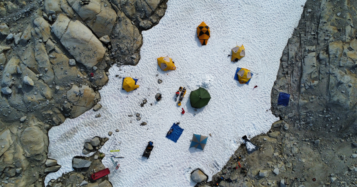
In 2022, Prof Davies joined the Juneau Icefield Research Programme (JIRP).
The JIRP was established in 1944 and each year it takes a group of students across the icefield over a period of eight to 10 weeks.
When in the rainforest and on the icefield, Prof Davies 'ground truthed' the geomorphological mapping – seeing her travel to moraines and other landforms that had been mapped from satellite imagery to investigate them in more detail.
Such ground truthing is conducted because there can be geometric issues in satellite images.
It also helps to understand the processes and dynamics of moraine formation, and to check that they were correctly mapped.
Why should we be concerned about accelerating glacial melt?
Since 2005, the Juneau Icefield has suffered a sharp acceleration in its glacial recession and volume loss. Prof Davies’s research has suggested that current glacier projections may underestimate glacier melt in the future.
The current projections for the Juneau icefield suggest ice volume loss will be linear until 2040, with it only accelerating after 2070. Armed with the latest research findings, Prof Davies believes that this may need to be updated to reflect what their latest research has discovered.
“We have been given new and unexpected insights into accelerating ice melt in Alaska and indeed, the Earth’s cryosphere.
As these changes are irreversible and accelerating, we will reach nature’s tipping point sooner than thought.
Juneau has shown us that we must be aware of where we are in terms of ice melt and how close we are to passing the threshold of recovery.”
Prof Bethan Davies, Newcastle University
How can Juneau’s data help predict future glacier behaviour?
Researchers fear that what is happening to the Juneau icefield is happening to others with similar characteristics.
This would include:
- Harding, Bagley and Kluane icefields in Alaska
- those in the Arctic e.g. Devon ice Cap, Agassiz Ice Cap and the Penny Ice Cap
- and also reaching Greenland and Norway, and glaciers surrounding the main Antarctic Peninsula Ice Sheet.
This research has taken a step towards understanding the physical processes that affect the different way icefields and ice caps respond to climate change – something that is key to improving our ability to estimate icefield response to future climate change.
Juneau has given us an insight into how we may need to upskill our ability to predict future melt. It has developed our understanding of ice dynamics and future sea level rise.
Similar processes as snowlines rise under ongoing climate warming and these major icefields reach regional; tipping points in mass change and volume loss.
“The accelerating glacial melt at Juneau means that the results from existing large scale, regional and global glacier model projects should be interpreted with care.” Prof Bethan Davies, Newcastle University
Prof Davies suggests that historical data should be integrated into future simulations through data-model comparisons to ensure melt-accelerating behaviours are anticipated, evaluated and accounted for.
Only by doing so, will we be able to assess the current ice melt – project future - and see where we are in terms of the threshold of recovery.
Acknowledgements
This research was funded by the Juneau Icefield Research Project, Royal Geographical Society and the Geological Society of London, and also NERC.
The research team would like to thank numerous colleagues and collaborators for fruitful discussions and support, including Fabien Maussion, Tamsin Edwards, Seth Campbell, and faculty and students from the Juneau Icefield Research Project. Jeremy Ely acknowledges support from a Natural Environment Research Council (NERC) independent fellowship (NE/R014574/1). Lindsey Nicholson was supported by research funds from the Faculty of Geo- and Atmospheric Sciences at the University of Innsbruck.
Fieldwork to Juneau Icefield by Bethan Davies and Lindsey Nicholson was supported by the Royal Geographical Society and the Geological Society, as well as the Juneau Icefield Research Project.
You might also like:
- to read the full research paper in Nature: Bethan Davies et al (2024) ‘Accelerating glacier volume loss on Juneau icefield driven by hypsometry and melt-accelerating feedbacks’, Nature Communications. DOI: 10.1038/s41467-024-49269-y
- to find out about the Juneau Icefield Research Programme
- to find out more about Dr Bethan Davies
- to find out more about Dr Robert McNabb
- watch the video: Are Alaska's Glaciers Approaching an Irreversible Tipping Point?
- read our blog about how we discovered an ancient river beneath the ice
- read our latest press release about Prof Davies' research about the Juneau icefield
- read Prof Davies' comment piece in The Conversation - Alaska's top heavy glaciers are approaching an irreversible tipping point
- explore our School of Geography, Politics and Sociology and more of our Geography research
