From tropical cyclones and floods to droughts and heatwaves, climate change is reshaping natural hazards.
Researchers at Newcastle University are analysing rainfall extremes, tropical cyclone dynamics, and the risks these pose for vulnerable regions like the Ganges-Brahmaputra-Meghna (GBM) basin in South Asia.
We spoke to Dr Haider Ali, Senior Researcher and lead author of a new study on monsoon dynamics in the GBM basin. Drawing on ground observations, satellite data, and climate models, his research shows how high-resolution modelling can reveal important shifts in rainfall patterns and deepen our understanding of monsoon change.
Contents
- The challenge facing a vast community
- Low vs high resolution models
- A more realistic picture of timing and intensity
- Looking at the bigger picture
- What's next?
The challenge facing a vast community
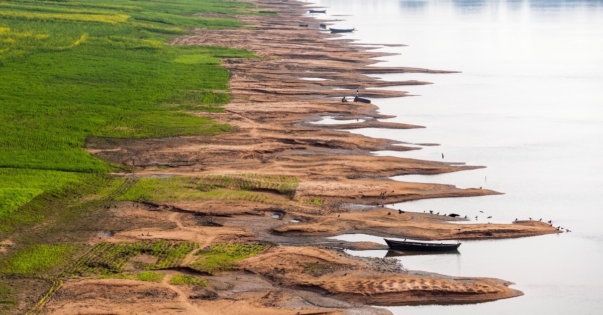
The monsoon season in South Asia is both a lifeline and a threat. In the GBM basin, monsoon rains sustain crops, recharge rivers, and underpin livelihoods. Yet the same rains can trigger flash floods, destroy fields, and create long dry spells that devastate communities.
The GBM basin
Location: spans Bangladesh, India, Nepal, Bhutan, and China
Size: ~1.7–1.75 million km²
Hydrology: the third-largest river system by water volume
Rivers: Ganges, Brahmaputra, and Meghna, converging in Bangladesh before reaching the Bay of Bengal
Population: supports over 500 million people
Agriculture: among the most fertile regions globally, with key crops including rice, wheat, jute, sugarcane, and tea
Low vs high resolution climate models
Predicting how the monsoon will change under climate change is one of the region’s most urgent scientific challenges. This research is part of a UK Research and Innovation Global Challenges Research Fund (UKRI GCRF) Living Deltas Hub project, which utilised climate models to improve the understanding of changes in tropical cyclone activity and monsoon behaviour over the South East Asia Delta.
Traditional climate models often rely on coarse grids of around 100 km, which smooth over the GBM basin’s complex rivers, wetlands, and coastlines. This can make it difficult to capture the timing of monsoon onset and withdrawal, or the extremes of rainfall that farmers and planners depend on.
To address this, Newcastle researchers compared low-resolution (~100 km) and high-resolution (~25–50 km) versions of the same climate models' family. This allowed them to test whether simply using a finer resolution helps in simulating the robust monsoon rainfall across the GBM basin, given that the models’ physics remain the same.
The study also used reference reanalyses rainfall datasets, which contain multiple observations, to check the models’ accuracy, looking not just at total rainfall but also the timing, duration, and intensity of the monsoon.
By changing only the resolution and keeping the models’ other properties the same, the study isolates the effect of finer grids on monsoon simulation. This provides new insights into how high-resolution climate models can better capture the dynamics of the South Asian monsoon.
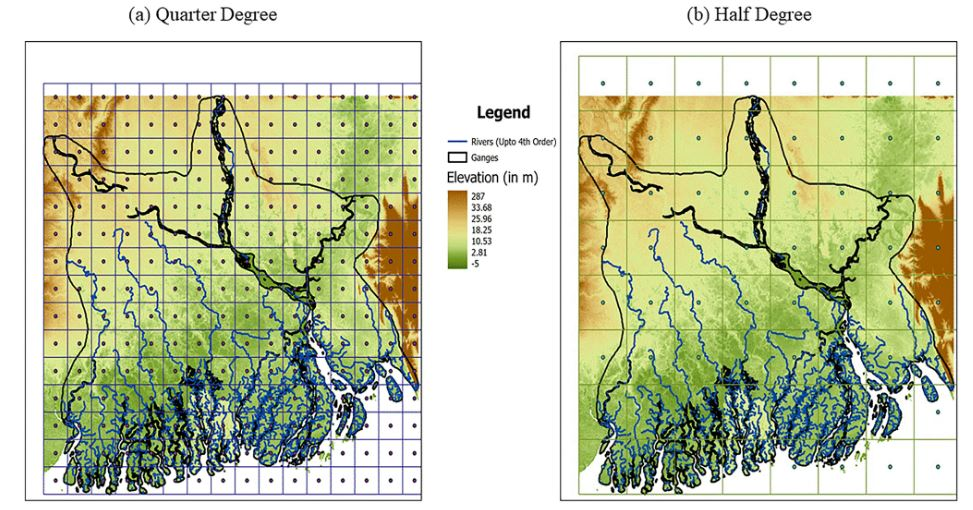
Figure 1. Boundary of the GBM basin showing elevation differences and river networks up to the 4th order. Panels a and b display the region with grid spacing of 0.25 and 0.5 degrees, respectively. Source: Ali, H., Fowler, H.J. & Turner, A.G. (2025)
Figure 1 highlights the complex orography of the basin, emphasising the need for high-resolution models to accurately capture local-scale processes. These are crucial for improving precipitation estimates, which can directly benefit the large population living in the region.
A more realistic picture of timing and intensity
The key findings from the high-resolution climate model analysis include:
- high-resolution models provide more accurate results — they capture monsoon timing, intensity, and duration more realistically
- monsoon timing is shifting — the models project a later monsoon onset and earlier withdrawal, shortening the season overall
- rainfall will be more intense — although the number of rainy days may decrease, when it does rain, it is likely to be heavier, raising the risk of flash floods
- validation matters — by checking models against observed rainfall, researchers showed high-resolution models carry lower biases than coarse versions, boosting confidence in their projections
- context is critical — these findings apply to the GBM basin; results may differ in other regions, highlighting the need for localised studies
Looking at the bigger picture
For farmers across the region, the timing of the monsoon governs when to plant and how to irrigate. A delayed onset could mean seeds in the ground without water; heavier bursts of rain could flatten fields just as crops mature. For communities, the stakes are just as high as shorter, more intense monsoons increase both drought and flood risks.
For decision-makers, this research delivers more trustworthy predictions. High-resolution modelling helps governments and planners prepare irrigation systems, strengthen flood defences, and build resilience against a future where rainfall is less predictable.
This isn’t just about better data. It’s about protecting lives and livelihoods.
What’s next?
Working with high-resolution models isn’t without debate. Some scientists question whether they can fully capture large-scale systems. In this study, finer-resolution models clearly reduced errors. But no model is perfect, and we can’t expect high-resolution models to perform similarly globally.
Looking ahead, researchers aim to improve models further. Not only by sharpening resolution, but also by refining how rainfall processes are represented. Extending data beyond 2050 will also help track longer-term risks.
‘It’s always important to go to this finer horizontal resolution to capture more details, especially in complex topographical areas like the Ganges-Brahmaputra-Meghna Delta. But it’s a balance. If you go too fine, you can lose the models’ ability to study the larger systems.’ – Dr. Haider Ali
Further information
- read the paper: Ali, H., Fowler, H.J. & Turner, A.G. High-resolution climate models improve simulation of monsoon rainfall changes in the Ganga–Brahmaputra-Meghna basin. Clim Dyn 63, 246 (2025). https://doi.org/10.1007/s00382-025-07716-6
- learn more about the authors:
- Dr Haider Ali, Senior Research Associate, School of Engineering, Newcastle University
- Professor Hayley Fowler, Professor of Climate Change Impacts, Newcastle University
- Professor Andrew Turner, Professor in Monsoon Systems, University of Reading
- explore more research from our School of Engineering in climate impacts and adaptation
- find out more about the UKRI GCRF Living Deltas Hub, the leading delta science and research partnership
