The UK has endured devastating extreme rainfall in the past few years, with flash floods causing property damage, economic disruption, and even loss of life.
However, research into this weather phenomenon by Newcastle University scientists could hold the secret to saving lives in the aftermath of supercell storms.
Working with the Met Office, we have developed a new model to significantly improve the prediction of life-threatening flash flooding. Read on to find out more.
Contents:
- What is a supercell?
- The impact of extreme weather
- Making life-saving predictions
- Being prepared – conclusion and implications
What is a supercell?
Thunderstorms can be split into four classifications – single-cell, multi-cell, squall line, and supercell. Of these four, the supercell is the rarest, and by far the most devastating.
Also known as ‘rotating thunderstorms’, supercells are large, slow-moving storms with a persistent rotating updraft, known as a mesocyclone. The pressure within a supercell can increase wind speeds within the updrafts and downdrafts, with some exceeding 40 metres per second. These storms are known for producing violent thunder and lightning, heavy hail, tornadoes, and massive amounts of rain over a short period of time, which can lead to flash floods.
Supercells can occur anywhere in the world when the conditions are right. Though they often occur in arid climates such as the Great Plains of central USA, they are not an exclusively American phenomenon: the first supercell was identified in 1962 over Wokingham, England.
The impact of extreme weather
As a result of urbanisation, land use, and increasing reliance on critical local and national infrastructure, society has become more vulnerable to flooding. Extreme rainfall affects both wealthy and poor countries alike, and there is evidence that the effects are only worsening as the world warms due to climate change.
Whereas longer-term flooding can last days or weeks, flash floods generally last less than six hours, are caused by short but high-volume extreme rainfall, and can arrive and leave with little warning. As a result, the risk of death from flash flooding is likely greater than from standard flooding from rivers and the sea combined[1].
These ‘surprise’ rainfall extremes can even catch professionals off guard. Forecasters often rely on weather parameters, such as precipitation rates and precipitable water, to predict weather patterns. However, these parameters have, in the past, been unable to take into consideration the onset of sudden extreme rainfall seen in a supercell storm. This can lead to massive underestimation of the intensity and downstream impact of an extreme rainfall event, leaving local responders with little time to take action and undermining public confidence in these services in the face of tragic events.
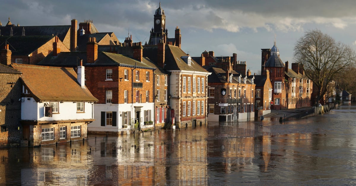
 Man paddles past a flooded building along the River Ouse, York.
Making life-saving predictions
To reduce the number of these ‘surprises’, the need to understand what causes rainfall extremes has to become a priority. With this in mind, Newcastle University and the Met Office led a study to develop a model that will help achieve more targeted early warnings and more precise forecasts.
Paul Davies is the study’s lead author, Met Office Principal Fellow, and Visiting Professor at Newcastle University’s School of Engineering. “In order to understand these extreme rainfall events, we have made an exciting discovery: the presence of a three-layered atmospheric structure, consisting of Moist Absolute Unstable Layers (MAUL) sandwiched between a stable upper layer and a near-stable low layer.”
Our researchers developed ways of recognising the patterns, drivers, and causal factors – in particular the atmospheric thermodynamics – that increase extreme sub-hourly rainfall. By analysing recent life-threatening extreme rainfall events, they were able to develop a four-stage conceptual model using ‘ingredients-based’ forecasting methods[2][3] that could indicate the formation of an impending rainfall event long before it occurs. The stages are as follows:
- Preconditioning; the creation of conditionally unstable layers conditioning the thermodynamics to build enough latent heat capacity for sub-hourly rainfall extremes.
- Lifting; realising latent heat through the lifting process to saturation.
- Realising; additional local warming ensues as convective instability is released across the MAUL leading to a period of sub-hourly extreme rainfall (super-CC rainfall).
- Transitioning; vertical atmospheric layers become neutrally stratified, thus rainfall returns to the CC rate, coupled with a decline in latent heat.
This study was supported by Universidad de Costa Rica, San Jose, Costa Rica and the Adam Mickiewicz University, Poznań, Poland, the full details of which were published in the journal, Weather and Climate Extremes.
 A supercell thunderstorm formed over flat land in Texas, May 2012.
Being prepared – conclusion and implications
According to Prof Davies, the new model “is aimed at enhancing the UK’s resilience to extreme weather events, which are becoming more frequent and intense due to climate change. This approach addresses the urgent need for improved prediction capabilities and will help both UK and global communities in mitigating the risks associated with increasingly extreme weather events.”
“The chances of anticipating extreme sub-hourly rainfall events will be maximised if features of the storm mesoscale environment, and storm morphology can be identified routinely by forecasters.” Prof Davies
The team have proposed their four-stage conceptual model to assist in the identification and forecasting of life-threatening short-duration extreme rainfall intensities and flash floods, offering clues as to where and when extremes are likely to occur.
This has the potential to aid forecasters in identifying and predicting dangerous flash floods, thereby improving public safety and preparedness.
Study co-author Hayley Fowler, Professor of Climate Change Impacts at Newcastle University, is delighted to help lead such exciting new research, saying that it “provides a paradigm shift in thinking about extreme rainfall processes.
“We will further develop this model into an operational system which can help to deliver on the UN’s call for Early Warnings for All, which aims to ensure universal protection from hazardous weather, water, or climate events through life-saving early warning systems by the end of 2027. With human-induced climate change leading to more extreme weather conditions, the need for accurate early warning systems is more critical now than ever before.”
You might also like:
- read the study: Paul A. Davies, Hayley J. Fowler, Roberto Villalobos Herrera, Julia Slingo, David L.A. Flack, Mateusz Taszarek, ‘A new conceptual model for understanding and predicting life-threatening rainfall extremes’, Weather and Climate Extremes, Volume 45, 2024, 100696, ISSN 2212-0947, https://doi.org/10.1016/j.wace.2024.100696. (https://www.sciencedirect.com/science/article/pii/S2212094724000574)
- learn more about the researchers involved in this study:
- Professor Hayley Fowler, Professor of Climate Change Impacts
- find out more through our story: New model to enhance extreme rainfall prediction
- discover more about Centre for Climate and Environmental Resilience, and the work of our research team in the Extreme Weather Adaptation Hub
- explore the latest research from our School of Engineering
- find out more about the work we do to promote sustainability and the environment through our One Planet hub

References:
[1] D.R. Archer, H.J. Fowler, Characterising flash flood response to intense rainfall and impacts using historical information and gauged data in Britain, Journal of Flood Risk Management, 11 (2018), pp. S121-S133, 10.1111/jfr3.12187
[2] C.A. Doswell, The distinction between large-scale and mesoscale contribution to severe convection: a case study example, Weather Forecast, 2 (1987), pp. 3-16, 10.1175/1520-0434(1987)002<0003:TDBLSA>2.0.CO;2
[3] C.A. Doswell, H.E. Brooks, R.A. Maddox, Flash flood forecasting: an ingredients-based methodology
Weather Forecast, 11 (1996), pp. 560-581, 10.1175/1520-0434(1996)011<0560:FFFAIB>2.0.CO;2